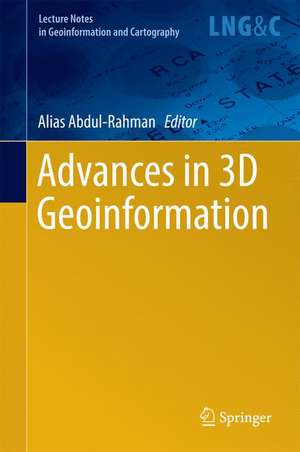
Advances in 3D Geoinformation: Lecture Notes in Geoinformation and Cartography
Editat de Alias Abdul-Rahmanen Limba Engleză Hardback – 18 oct 2016
The book presents a collection of accepted papers from the 3DGeoinfo 2015 international conference held in Kuala Lumpur, Malaysia from October 28 – 30, 2015. All papers underwent double-blind review by experts from around the globe. The conference brought together pioneering international researchers and practitioners to facilitate the dialogue on emerging topics in the field of 3D geo-information. The focus areas include:
- Data Collection and Modeling: advanced approaches for 3D data collection, reconstruction and methods for representation
- Data Management: topological, geometrical and network models for maintenance of 3D geoinformation
- Data Analysis and Visualization: frameworks for representing 3D spatial relationships, 3D spatial analysis and algorithms for navigation, interpolation, advanced VR, AR and MR visualisation, as well as 3D visualization on mobile devices
- 3D Applications: city models, Cadastre, LBS, etc.
| Toate formatele și edițiile | Preț | Express |
|---|---|---|
| Paperback (1) | 1227.36 lei 6-8 săpt. | |
| Springer International Publishing – 16 iun 2018 | 1227.36 lei 6-8 săpt. | |
| Hardback (1) | 1233.69 lei 6-8 săpt. | |
| Springer International Publishing – 18 oct 2016 | 1233.69 lei 6-8 săpt. |
Din seria Lecture Notes in Geoinformation and Cartography
- 18%
 Preț: 1420.09 lei
 - 20%
 Preț: 569.73 lei
 - 18%
 Preț: 951.29 lei
 - 18%
 Preț: 963.15 lei
 - 18%
 Preț: 948.16 lei
 - 18%
 Preț: 951.47 lei
 - 18%
 Preț: 1228.47 lei
 - 18%
 Preț: 956.33 lei
 - 18%
 Preț: 1251.82 lei
 - 18%
 Preț: 956.03 lei
 - 18%
 Preț: 1235.43 lei
 - 18%
 Preț: 940.87 lei
 - 18%
 Preț: 1845.48 lei
 - 15%
 Preț: 644.95 lei
 - 18%
 Preț: 945.79 lei
 - 18%
 Preț: 948.16 lei
 - 18%
 Preț: 1245.34 lei
 - 18%
 Preț: 961.23 lei
 - 18%
 Preț: 1239.49 lei
 - 18%
 Preț: 947.35 lei
 - 18%
 Preț: 957.62 lei
 - 5%
 Preț: 1104.48 lei
 - 18%
 Preț: 1232.26 lei
 - 18%
 Preț: 1420.09 lei
 - 18%
 Preț: 952.57 lei
 - 18%
 Preț: 959.36 lei
 - 18%
 Preț: 953.82 lei
 - 18%
 Preț: 953.20 lei
 - 18%
 Preț: 1233.06 lei
 - 18%
 Preț: 950.52 lei
 - 18%
 Preț: 947.35 lei
 - 18%
 Preț: 1234.62 lei
 - 20%
 Preț: 558.62 lei
 - 18%
 Preț: 957.62 lei
 - 18%
 Preț: 1226.73 lei
 - 18%
 Preț: 1233.69 lei
 - 18%
 Preț: 947.85 lei
 - 18%
 Preț: 952.09 lei
 - 18%
 Preț: 1242.03 lei
 - 18%
 Preț: 1550.30 lei
 - 18%
 Preț: 953.65 lei
Preț: 1233.69 lei
Preț vechi: 1504.49 lei
-18% Nou
Puncte Express: 1851
Preț estimativ în valută:
236.07€ • 247.61$ • 196.52£
236.07€ • 247.61$ • 196.52£
Carte tipărită la comandă
Livrare economică 01-15 aprilie
Preluare comenzi: 021 569.72.76
Specificații
ISBN-13: 9783319256894
ISBN-10: 3319256890
Pagini: 200
Ilustrații: VII, 512 p. 266 illus., 204 illus. in color.
Dimensiuni: 155 x 235 x 29 mm
Greutate: 0.9 kg
Ediția:1st ed. 2017
Editura: Springer International Publishing
Colecția Springer
Seria Lecture Notes in Geoinformation and Cartography
Locul publicării:Cham, Switzerland
Public țintă
ResearchCuprins
Realistic benchmarks for point cloud data management systems.- Does a finer level of detail of a 3D city model bring an improvement for estimating shadows?.- Interactive and view-dependent see-through lenses for massive 3D point clouds.- Representative for CityGML instance models in BaseX.- A 3D LADM prototype implementation in INTERLIS.- Web-based tool for the sustainable refurbishment in historic districts based on 3D city model.- Comparison of 2D and 3D parameter-based models in urban fine dust distribution modelling.- Investigating semantic functionality of 3D geometry for land administration.- 3D complete traffic noise analysis based on CityGML.- Automatic semantic and geometric enrichment of CityGML building models using HoG-based template matching.- Stochastic buildings generation to assist in the design of right to build plans.- 3D marine administration system based on LADM.- A data model for the interactive construction and correction of 3D building geometry based on planarhalf-spaces.- The potential of 3D Dual Half-Edge (DHE) data structure for integrated 2D-space and scale modelling: a review.- Towards integrating BIM and GIS – an end-to-end example from point cloud to analysis
Textul de pe ultima copertă
The book presents a collection of accepted papers from the 3DGeoinfo 2015 international conference held in Kuala Lumpur, Malaysia from October 28 – 30, 2015. All papers underwent double-blind review by experts from around the globe. The conference brought together pioneering international researchers and practitioners to facilitate the dialogue on emerging topics in the field of 3D geo-information. The focus areas include:
- Data Collection and Modeling: advanced approaches for 3D data collection, reconstruction and methods for representation
- Data Management: topological, geometrical and network models for maintenance of 3D geoinformation
- Data Analysis and Visualization: frameworks for representing 3D spatial relationships, 3D spatial analysis and algorithms for navigation, interpolation, advanced VR, AR and MR visualisation, as well as 3D visualization on mobile devices
- 3D Applications: city models, Cadastre, LBS, etc.
Caracteristici
Explores recent 3D GIS research findings Provides details of the latest global 3D GIS trends Presents cutting-edge information on the 3D GIS research agenda Includes supplementary material: sn.pub/extras
