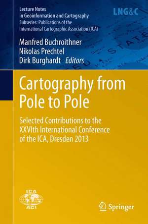
Cartography from Pole to Pole: Selected Contributions to the XXVIth International Conference of the ICA, Dresden 2013: Lecture Notes in Geoinformation and Cartography
Editat de Manfred Buchroithner, Nikolas Prechtel, Dirk Burghardten Limba Engleză Hardback – 26 aug 2013
| Toate formatele și edițiile | Preț | Express |
|---|---|---|
| Paperback (1) | 947.90 lei 6-8 săpt. | |
| Springer Berlin, Heidelberg – 27 aug 2016 | 947.90 lei 6-8 săpt. | |
| Hardback (1) | 952.12 lei 6-8 săpt. | |
| Springer Berlin, Heidelberg – 26 aug 2013 | 952.12 lei 6-8 săpt. |
Din seria Lecture Notes in Geoinformation and Cartography
- 18%
 Preț: 1409.60 lei
 - 20%
 Preț: 569.73 lei
 - 18%
 Preț: 944.27 lei
 - 18%
 Preț: 956.05 lei
 - 18%
 Preț: 941.16 lei
 - 18%
 Preț: 944.44 lei
 - 18%
 Preț: 1219.40 lei
 - 18%
 Preț: 949.28 lei
 - 18%
 Preț: 1242.58 lei
 - 18%
 Preț: 948.97 lei
 - 18%
 Preț: 1226.31 lei
 - 18%
 Preț: 933.95 lei
 - 18%
 Preț: 1831.83 lei
 - 15%
 Preț: 640.22 lei
 - 18%
 Preț: 938.82 lei
 - 18%
 Preț: 941.16 lei
 - 18%
 Preț: 1236.15 lei
 - 18%
 Preț: 954.16 lei
 - 18%
 Preț: 1230.35 lei
 - 18%
 Preț: 940.38 lei
 - 18%
 Preț: 950.57 lei
 - 5%
 Preț: 1096.34 lei
 - 18%
 Preț: 1223.17 lei
 - 18%
 Preț: 1409.60 lei
 - 18%
 Preț: 945.55 lei
 - 18%
 Preț: 952.29 lei
 - 18%
 Preț: 946.79 lei
 - 18%
 Preț: 946.17 lei
 - 18%
 Preț: 1223.95 lei
 - 18%
 Preț: 943.51 lei
 - 18%
 Preț: 940.38 lei
 - 18%
 Preț: 1225.52 lei
 - 20%
 Preț: 558.62 lei
 - 18%
 Preț: 950.57 lei
 - 18%
 Preț: 1217.67 lei
 - 18%
 Preț: 1224.58 lei
 - 18%
 Preț: 940.86 lei
 - 18%
 Preț: 945.06 lei
 - 18%
 Preț: 1232.88 lei
 - 18%
 Preț: 1538.85 lei
 - 18%
 Preț: 946.62 lei
Preț: 952.12 lei
Preț vechi: 1161.12 lei
-18% Nou
Puncte Express: 1428
Preț estimativ în valută:
182.34€ • 186.07$ • 153.41£
182.34€ • 186.07$ • 153.41£
Carte tipărită la comandă
Livrare economică 25 februarie-11 martie
Preluare comenzi: 021 569.72.76
Specificații
ISBN-13: 9783642326172
ISBN-10: 364232617X
Pagini: 516
Ilustrații: XVII, 496 p. 224 illus., 164 illus. in color.
Dimensiuni: 155 x 235 x 33 mm
Greutate: 0.84 kg
Ediția:2014
Editura: Springer Berlin, Heidelberg
Colecția Springer
Seriile Lecture Notes in Geoinformation and Cartography, Publications of the International Cartographic Association (ICA)
Locul publicării:Berlin, Heidelberg, Germany
Public țintă
ResearchCuprins
Art and Cartography.- Atlases.- Cartography and Children.- Cartography in Early Warning and Crisis Management.- Cognitive Visualization.- Data Quality.- Digital Technologies in Cartographic Heritage.- Education and Training.- Generalization and Multiple Representation.- Geoinformation Infrastructures and Standards.- Geospatial Analysis And Modeling.- Geovizualisation.- Geoinformation for Sustainability.
Textul de pe ultima copertă
This volume comprehends a selection of papers presented during the 26th International Cartographic Conference held in Dresden from the 26th to the 30th of August 2013. It covers many fields of relevant Mapping and GIS research subjects, such as cartographic applications, cartographic tools, generalisation and update Propagation, higher dimensional visualisation and augmented reality, planetary mapping issues, cartography and environmental modelling, user generated content and spatial data infrastructure, use and usability as well as cartography and GIS in education.
Caracteristici
Spans the whole scientific discipline from questions of appropriate geo-data sources over various forms of processing the geo-data, to an appropriate cartographic design and answers related to the user-interaction and perception of the cartographic products Gives a comprehensive account of topic geographic issues Publication of the International Cartographic Association (ICA) Includes supplementary material: sn.pub/extras
