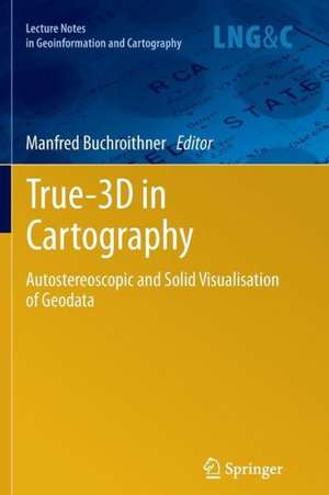
True-3D in Cartography: Autostereoscopic and Solid Visualisation of Geodata: Lecture Notes in Geoinformation and Cartography
Editat de Manfred Buchroithneren Limba Engleză Paperback – 22 feb 2014
| Toate formatele și edițiile | Preț | Express |
|---|---|---|
| Paperback (1) | 1227.67 lei 43-57 zile | |
| Springer Berlin, Heidelberg – 22 feb 2014 | 1227.67 lei 43-57 zile | |
| Hardback (1) | 1233.06 lei 43-57 zile | |
| Springer Berlin, Heidelberg – 5 ian 2012 | 1233.06 lei 43-57 zile |
Din seria Lecture Notes in Geoinformation and Cartography
- 18%
 Preț: 1420.09 lei
 - 20%
 Preț: 569.73 lei
 - 18%
 Preț: 951.29 lei
 - 18%
 Preț: 963.15 lei
 - 18%
 Preț: 948.16 lei
 - 18%
 Preț: 951.47 lei
 - 18%
 Preț: 1228.47 lei
 - 18%
 Preț: 956.33 lei
 - 18%
 Preț: 1251.82 lei
 - 18%
 Preț: 956.03 lei
 - 18%
 Preț: 1235.43 lei
 - 18%
 Preț: 940.87 lei
 - 18%
 Preț: 1845.48 lei
 - 15%
 Preț: 644.95 lei
 - 18%
 Preț: 945.79 lei
 - 18%
 Preț: 948.16 lei
 - 18%
 Preț: 1245.34 lei
 - 18%
 Preț: 961.23 lei
 - 18%
 Preț: 1239.49 lei
 - 18%
 Preț: 947.35 lei
 - 18%
 Preț: 957.62 lei
 - 5%
 Preț: 1104.48 lei
 - 18%
 Preț: 1232.26 lei
 - 18%
 Preț: 1420.09 lei
 - 18%
 Preț: 952.57 lei
 - 18%
 Preț: 959.36 lei
 - 18%
 Preț: 953.82 lei
 - 18%
 Preț: 953.20 lei
 - 18%
 Preț: 1233.06 lei
 - 18%
 Preț: 950.52 lei
 - 18%
 Preț: 947.35 lei
 - 18%
 Preț: 1234.62 lei
 - 20%
 Preț: 558.62 lei
 - 18%
 Preț: 957.62 lei
 - 18%
 Preț: 1226.73 lei
 - 18%
 Preț: 1233.69 lei
 - 18%
 Preț: 947.85 lei
 - 18%
 Preț: 952.09 lei
 - 18%
 Preț: 1242.03 lei
 - 18%
 Preț: 1550.30 lei
 - 18%
 Preț: 953.65 lei
Preț: 1227.67 lei
Preț vechi: 1497.16 lei
-18% Nou
Puncte Express: 1842
Preț estimativ în valută:
234.94€ • 243.89$ • 195.90£
234.94€ • 243.89$ • 195.90£
Carte tipărită la comandă
Livrare economică 24 martie-07 aprilie
Preluare comenzi: 021 569.72.76
Specificații
ISBN-13: 9783642431883
ISBN-10: 3642431887
Pagini: 528
Ilustrații: XVIII, 510 p.
Dimensiuni: 155 x 235 x 28 mm
Greutate: 0.73 kg
Ediția:2012
Editura: Springer Berlin, Heidelberg
Colecția Springer
Seria Lecture Notes in Geoinformation and Cartography
Locul publicării:Berlin, Heidelberg, Germany
ISBN-10: 3642431887
Pagini: 528
Ilustrații: XVIII, 510 p.
Dimensiuni: 155 x 235 x 28 mm
Greutate: 0.73 kg
Ediția:2012
Editura: Springer Berlin, Heidelberg
Colecția Springer
Seria Lecture Notes in Geoinformation and Cartography
Locul publicării:Berlin, Heidelberg, Germany
Public țintă
ResearchCuprins
Geovisualization.- True-3D, 3D Modelling, VR Cartography, Stereo Film Animation.
Textul de pe ultima copertă
As corroborated by the never-sagging and even increasing interest within the last decade, the intuitive attraction of "True 3D" in geodata presentation is well worth covering its current status and recent developments in a compendium like the present one. It covers most aspects of (auto-) stereoscopic representation techniques of both topographic and thematic geodata, be they haptic or not. Theory is treated as well as are many fields of concrete applications. Displays for big audiences and special single-user applications are presented, well-established technologies like classical manual fabrication of landscape reliefs contrast with cutting-edge developments
Caracteristici
Up-to-date coverage of the techniques presently in use Focuses on visualisation modules of GI software and systems Meant as a guide to researchers and practitioners to assess the current state of True 3D support in cartography and GI Systems
