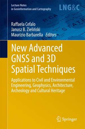
New Advanced GNSS and 3D Spatial Techniques: Applications to Civil and Environmental Engineering, Geophysics, Architecture, Archeology and Cultural Heritage: Lecture Notes in Geoinformation and Cartography
Editat de Raffaela Cefalo, Janusz B. Zieliński, Maurizio Barbarellaen Limba Engleză Hardback – 8 iul 2017
It offers an updated reference guide on the above-mentioned topics for undergraduate and graduate students, PhDs, researchers, professionals and practitioners alike.
| Toate formatele și edițiile | Preț | Express |
|---|---|---|
| Paperback (1) | 1380.16 lei 6-8 săpt. | |
| Springer International Publishing – 3 aug 2018 | 1380.16 lei 6-8 săpt. | |
| Hardback (1) | 1386.17 lei 6-8 săpt. | |
| Springer International Publishing – 8 iul 2017 | 1386.17 lei 6-8 săpt. |
Din seria Lecture Notes in Geoinformation and Cartography
- 18%
 Preț: 1420.09 lei
 - 20%
 Preț: 569.73 lei
 - 18%
 Preț: 951.29 lei
 - 18%
 Preț: 963.15 lei
 - 18%
 Preț: 948.16 lei
 - 18%
 Preț: 951.47 lei
 - 18%
 Preț: 1228.47 lei
 - 18%
 Preț: 956.33 lei
 - 18%
 Preț: 1251.82 lei
 - 18%
 Preț: 956.03 lei
 - 18%
 Preț: 1235.43 lei
 - 18%
 Preț: 940.87 lei
 - 18%
 Preț: 1845.48 lei
 - 15%
 Preț: 644.95 lei
 - 18%
 Preț: 945.79 lei
 - 18%
 Preț: 948.16 lei
 - 18%
 Preț: 1245.34 lei
 - 18%
 Preț: 961.23 lei
 - 18%
 Preț: 1239.49 lei
 - 18%
 Preț: 947.35 lei
 - 18%
 Preț: 957.62 lei
 - 5%
 Preț: 1104.48 lei
 - 18%
 Preț: 1232.26 lei
 - 18%
 Preț: 1420.09 lei
 - 18%
 Preț: 952.57 lei
 - 18%
 Preț: 959.36 lei
 - 18%
 Preț: 953.82 lei
 - 18%
 Preț: 953.20 lei
 - 18%
 Preț: 1233.06 lei
 - 18%
 Preț: 950.52 lei
 - 18%
 Preț: 947.35 lei
 - 18%
 Preț: 1234.62 lei
 - 20%
 Preț: 558.62 lei
 - 18%
 Preț: 957.62 lei
 - 18%
 Preț: 1226.73 lei
 - 18%
 Preț: 1233.69 lei
 - 18%
 Preț: 947.85 lei
 - 18%
 Preț: 952.09 lei
 - 18%
 Preț: 1242.03 lei
 - 18%
 Preț: 1550.30 lei
 - 18%
 Preț: 953.65 lei
Preț: 1386.17 lei
Preț vechi: 1690.45 lei
-18% Nou
Puncte Express: 2079
Preț estimativ în valută:
265.25€ • 277.64$ • 220.77£
265.25€ • 277.64$ • 220.77£
Carte tipărită la comandă
Livrare economică 31 martie-14 aprilie
Preluare comenzi: 021 569.72.76
Specificații
ISBN-13: 9783319562179
ISBN-10: 3319562177
Pagini: 193
Ilustrații: XII, 283 p. 151 illus., 111 illus. in color.
Dimensiuni: 155 x 235 mm
Greutate: 0.59 kg
Ediția:1st ed. 2018
Editura: Springer International Publishing
Colecția Springer
Seria Lecture Notes in Geoinformation and Cartography
Locul publicării:Cham, Switzerland
Cuprins
Part 1: New Advanced GNSS and 3D Spatial Techniques – Applications to Geodetic Networks, Mapping, Static and Kinematic positioning and Timing.- High Precision GNSS – prospects for science and applications.- Space time and maps.- The actual perspectives of GNSS multi-constellation services and receivers for kinematic applications.- FReDNet: evolution of a permanent GNSS receiver system.- Part 2: New Advanced GNSS and 3D Spatial Techniques Applications to Photogrammetry and Remote Sensing.- Procrustean Photogrammetry: From Exterior Orientation to Bundle Adjustment.- Towards Surveying with A Smartphone.- Evaluation of 3D reconstruction accuracy in the case of stereo camera-pose configuration.- Doing Science with Nano-Satellites.- Part 3: New Advanced GNSS and 3D Spatial Techniques Application to GIS, Web GIS, UAVs, Disaster Management and Cultural Heritage.- Optimization of a co-generative biomass plant location using open source GIS techniques. Technical, economical and environmental validation methodology.- Geography of WWI sites along the Italian front by means of GIS tools.- Ionosphere TEC variations over Bosnia and Herzegovina using GNSS data
Textul de pe ultima copertă
This book provides the latest research on and applications of advanced GNSS (Global Navigation Satellite System) and 3D spatial techniques in the fields of Civil and Environmental Engineering, Geophysics, Architecture, Archaeology and Cultural Heritage.
It offers an updated reference guide on the above-mentioned topics for undergraduate and graduate students, PhDs, researchers, professionals and practitioners alike.
It offers an updated reference guide on the above-mentioned topics for undergraduate and graduate students, PhDs, researchers, professionals and practitioners alike.
Caracteristici
Covers the state of the art in research and development (R&D) activities at European high education and research centers Also includes applications of the research fields presented, offering useful resources for engineering and surveying professionals Prepared by authors who are representative of internationally respected higher education centers Includes supplementary material: sn.pub/extras
